Home
Equipment
Basics
Trips
What's New?
About Us


More Central Florida trips and chat here.


US Fish and Wildlife:
Pelican Island NWR


Club Kayak Home


Pelican Island NWR Banner

Pelican Island National Wildlife Refuge

Next Page

Difficulty: Basic Scenery: Good
Location: Vero Beach,
Indian River County
Distance: 7 mile round trip from Wabasso Island to Pelican Island.
Atlas: Page 96 B-3
Last Update: August 2003 Canoe OK: No

Photos only Photo-trip - limited details.

Description

Pelican Island National Wildlife Refuge (NWR) holds a unique place in American history. On March 14, 1903 by Executive Order and a stroke of President Theodore Roosevelt's pen, the tiny 5.5 acre island (now much smaller) became America's first national wildlife refuge. From its humble beginning, the Refuge now exceeds 5,300 acres with 4,760 acres of submerged bottom lands and mangrove islands.

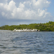
The Refuge is home to more than 90 species of birds including brown and white pelicans, several types of egrets, heron, wood storks, white ibis, cormorants and many others. While you'll get a good opportunity to bird watch, getting a glimpse of the endangered West Indian manatee, green sea turtle or loggerhead sea turtle that also share the Refuge may prove to be a bit trickier.

The trip from the put-in at Wabasso Island Causeway Park to Pelican Island and back is 7 miles in length. To begin, paddle under the causeway bridge and go to the north end of Wabasso Island. Turn east until you reach the East Channel at the high Wabasso Bridge (the Intercoastal follows the west channel). Go north along the mangrove-lined East Channel and Spratt Creek for four miles. Pelican Island is 1/4 mile west of the brown observation tower. You will easily spot the small island with its many resident pelicans. To return along the Intercoastal, paddle west to Pauls Island and turn south. Once past the mangroves of Pauls Island, you should be able to see the Wabasso Island causeway bridge at 2.5 miles distant.

Access

From the intersection of SR 60 and I-95 in Vero Beach, go east on SR 60 to US 1. Turn north (left) on US 1 and go approximately 10 miles to the small town of Wabasso. Turn east (right) on County Road 510. Cross over the flat causeway bridge. At the east end of the bridge is Wabasso Causeway Park and boat ramp. Put-in at the boat ramp or anywhere along the south side of the park. You can also access Wabasso and Pine Islands from this put-in.

Pelican Island National Wildlife Refuge Photographs

Pelican Island NWR;birds.

Pelican Island NWR
Pelican Island is part of the Indian River Lagoon ecosystem, an incredibly diverse habitat with over 4,300 species of wildlife and plants. The Refuge consists of wetlands, mangrove habitats and maritime hardwood hammocks. You can access the land portion of the Refuge by going north of CR510 on Highway A1A.
Pelican Island NWR;Waterway Signs.

Waterways
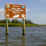
Most of the waterways between Wabasso and Pelican Islands average 1 to 4 feet deep with a mud and seagrass bottom. Areas east of the Intercoastal channel are no-wake manatee zones. Be careful when crossing the Intercoastal at the north end of Wabasso Island.
Pelican Island NWR;White Pelican.

White Pelican
Pelecanus erythrorhynchos
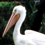
The white pelican is all white in color, with orange-yellow bill, legs and webbed feet. It is a large bird, with a wing span of up to 8 feet. The white pelican feeds from the water surface and does not dive from the air like the brown pelican. It can often be seen resting on sandbars.
Pelican Island NWR;Brown Pelican.

Brown Pelican
Pelecanus occidentalis
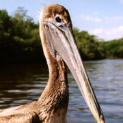
The brown pelican is very common to Florida and slightly smaller than its white cousin. Its body is grayish-brown and head and neck change color between brown in summer and white in winter. Rests in trees.
Pelican Island NWR;Pauls Island.

Pauls Island
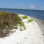
Pauls Island is located approximately 1/3 mile due west of Pelican Island. A small sandy beach is on the east side of the island and tall Australian Pines provide shade for a picnic lunch or quick rest stop. Red Mangroves cover most of the west side of the island.
Pelican Island NWR;Weather.

Weather
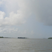
There are few places to land along the mangrove-lined East Channel and Spratt Creek and summer rainstorms can develop quickly. Fortunately for our trip, the rains held until we crossed over to the west (channel) side of Preachers Island.

References

Alden, P., Cech, R., Nelson, G. (1998) National Audubon Society Field Guide to Florida, Chanticleer Press, Inc., New York, NY