| Cedar
Keys |
 |
| Difficulty: Moderate
to Advanced |
Scenery: Good |
Location: Cedar Key,
Levy County |
Distance: 5 miles
round-trip
Cedar Key to Snake Key |
| Atlas: Page 69 C-3 |
| Last Update: November 2003 |
Canoe OK: No |
 Photo-trip
- limited details. Photo-trip
- limited details.
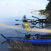
Description
Cedar Key is a quiet island community of about 700 residents located
on the Gulf of Mexico along the big bend of Florida. During the
1800s, this area was once a bustling sea port and has many interesting
historical sites and fun new developments. Paddling is great at
Cedar Keys as long as you remember to watch the tides and oyster
bars.
The island is surrounded by 13 smaller barrier islands in the Cedar
Key National Wildlife Refuge which was established in 1929 by President
Hoover. The area is home to and protected breeding grounds for many
different species of birds including ibis, egrets, heron, pelicans
and cormorants. Plants common to the area include saw palmetto,
cabbage palm, live oak and, as the name of the islands indicates,
cedar trees.
Access
The nearest large city is Gainesville, approximately 50 miles to
the northeast. From I-75 in Gainesville turn west on SR 24 (Exit
384, old #75) to Bronson. Continue west on SR 24 past Otter Creek
to Cedar Keys. Follow signs to the "Big Docks". A small
city park (Swim Beach) with parking, restrooms and boat ramp are
located just before the docks.
Cedar Keys Photographs
|
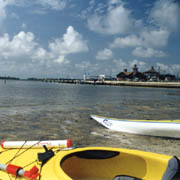
Swim Beach at City Park
The swim beach at City Park is one of the few sandy beach areas
in Cedar Key. Most of Cedar Key and neighboring islands are
surrounded by shallow water and oyster bars. |
|
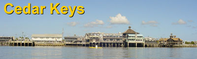
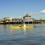
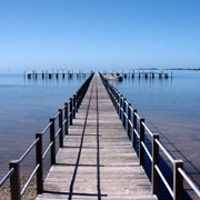
Cedar Key Big Docks
On the way to Atsena Otie Key, you'll pass the Big Docks. This
popular area offers good food, shopping and a number of art
galleries. It makes a great place to stop for lunch after your
paddle trip. |
|
Atsena Otie Key
Heading south, Atsena Otie is a short 3/4 mile paddle from the
Cedar Key Big Docks. Atsena Otie has a dock, hiking trails and
an old cemetery that makes for interesting exploring.
With the exception of Atsena Otie Key, the interior of all other
islands is closed. |
|
Atsena Otie Dock
In the 1800s Atsena Otie Key was the site of Eagle Pencil Company's
Cedar Key factory. The plant operated until nearly all cedar
trees in the area were depleted. |
|
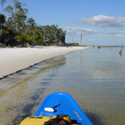
Beach at Snake Key
Continuing south for two miles past Atsena Otie, Snake Key is
one of the southern most islands in the Cedar Key National Wildlife
Refuge. By the way, there really are snakes on Snake Key (as
well as most other islands in this area). |
|
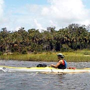
Fishing at Snake Key
Beside a nice beach, Snake Key offers great fishing. Bring a
rod and try your luck for redfish.
For the more adventurous paddler, the next stop 2 miles to the
west is Seahorse Key. Note the island is closed to all access
from March 1 to June 30 to protect nesting birds. |
|


)
)
)